Thinking we were both excellent navigators, skilled in reading topo maps and driving on forest roads, Andy and I set out to find an elusive pair of waterfalls on Rattlesnake Creek, a few miles upstream from where we live. Feeling perhaps a bit overconfident, I didn't really start looking at the topo map too closely until we "felt" we were in the right place. A more anal navigator would have counted the drainages, and traced the road, following landmarks as we passed them by. Instead, I chatted away like we knew exactly where we were meant to stop the car and start hiking, even though neither of us had ever driven very far up Rattlesnake Road. When we reached the spot, we glanced at the map, made the landscape fit the topographical lines on the map, and started hiking down a road in the direction we thought the falls might be. We thought we even heard the creek roaring in the distance, reinforcing our gut feelings.
After about 10 minutes, we decided that the roar we heard was actually the sound of the wind in the treetops, and that we were just too far away from the creek to possibly be on the right track. And the road was way too steep and windy, contrary to what the map showed the correct road to be like.
Hiking back to the car, we decided that somehow we hadn't gone far enough. We continuted up the same road, which by all appearances seemed to be the right road, again making the spur roads and intersections, and even a freshly sawn out tree in the road, fit the map and Jaco's description of the area. Taking the appropriate right hand road, we stopped the car when the road became undriveable, and walked about a hundred yards or so, only to find ourselves at someone's ranch, which was located on the edge of an open, flat, marshy looking meadow. At that point we realized we had gone way too far and decided to retrace our steps starting from where the road left Rattlesnake Creek and started climbing. This time I would not neglect my duties as Navigator.
Everything worked out to a point, until the roads started not to match the map again. It didn't make sense, we were on the main road as we should have been and hadn't turned off. Jaco's highlighted route seemed pretty straightforward, were we really that incompetent without roadsigns?
Because we so strongly didn't want to give up on our initial road, we decided to drive down the road we first walked down. We came to and passed a few little intersections, then came to some small trees in the road and turned around. Foiled again! Feeling desperate at this point, we thought maybe we were too high and needed to take a lower road nearer to the creek, so we took the next turn off the main rad as we headed back downstream, only to find ourselves stopped by the very same trees in the road, having successfully completed a loop!
Deflated, we drove back to Wet Planet, wondering how 2 experienced outdoorspeople could be so easily confused while driving with a map. I started to think that maybe I have just been spending way too much indoors, doing too much blogging and drinking coffee and not enough exploring. I mean really, the days when I lived out of a backpack and didn't even need a trail to navigate the Bob Marshall Wilderness seem like a lifetime ago; finding a little ol' logging road in the highly populated wilds of the Gifford Pinchot National Forest should have been a bit more doable for someone like me. I couldn't help thinking "Has it really come to this??". Wow, and if so, perhaps it's time to trade the laptop in for some new hiking boots and a compass. And really get back to my roots. After all, as a good friend once put it, I am "from further back in the woods than most people have ever been".
Andy asked Todd, who has actually located and visited the waterfalls, where we had gone wrong. It turns out that our first road and gut instinct was correct, only we approached it from the north the first time and didn't go far enough. We should have taken the lower road, even though Jaco had told us to stay on the "main road", and approached it from the south. The trees were the trees that also stopped Todd and Jaco, and where they started hiking from.
So we were close, very close! Maybe our skills weren't so inexcusably pitiful after all! Maybe I haven't turned into a full-fledged softie who can't find her way around the woods.
Either way, it was an adventure. And has inspired me to seek out some new ones right around here, right in my back yard, getting back to finding unknown paths and places, even if they aren't remote, aren't in a foreign country, or aren't even wild. It's all about working with what you've got.


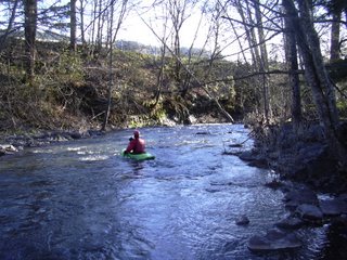
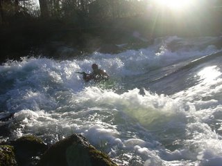
Photos, top to bottom: Andy putting on Rattlesnake in our back "yard", and much downstream of the falls; Andy gettin' it in Rattlesnake, a sort of sweet revenge perhaps?


